Items
Log in if you have an account
Dont have an account? Register
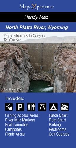
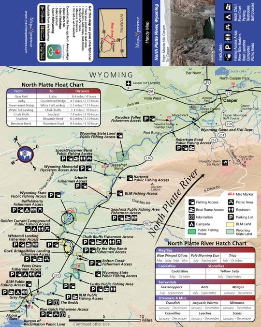
Our paper map folds to a convenient 3" x 6" size, perfect for your tackle box or pocket. Unfolded size is 12" x 15" in full color and easy to read. A perfect reference for use when out on the water.
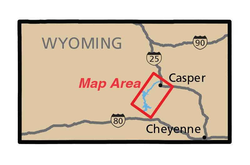
The North Platte River map includes hatch and float charts, fishing access areas, parking areas, river mile markers, restrooms, picnic areas, campsites, boat launch areas and BLM Lands. Coverage area is roughly 75 river miles from the Seminoe Reservoir travelling north along the flow to Casper.
The North Platte River is a blue ribbon trout stream and has been dammed several times to form several reservoirs along its course. The Seminoe Reservoir, formed by Seminoe Dam, the Kortes Reservoir and still further downstream is the Pathfinder Reservoir. Northeast of the Pathfinder Reservoir the river passes through the Alcova and Gray Reef Reservoirs before it hits Casper.
Get the latest updates, news and product offers.