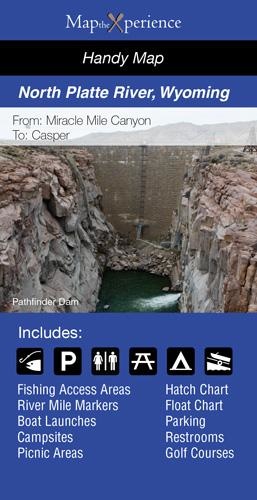
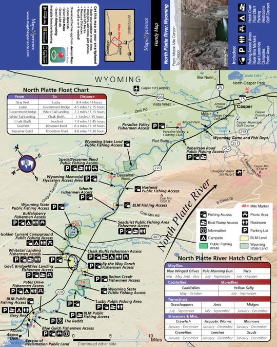
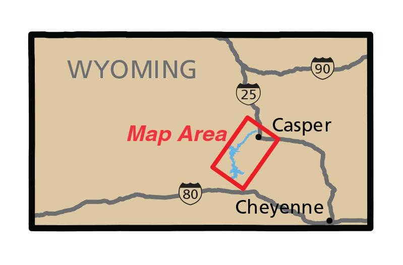
NORTH PLATTE RIVER PAPER MAP
A map custom built to reflect our favorite public access points, boat ramps, and hatches.
In stock, ready to ship.


A map custom built to reflect our favorite public access points, boat ramps, and hatches.
In stock, ready to ship.